As I started to observe ‘Maker’s Marks’ along my defined route through Somers Town, I became fascinated with the history of the site and the cause for the variation in it’s building typologies’. To gain a better understanding of how the area has developed over time, I began to research where urban regeneration had taken place.
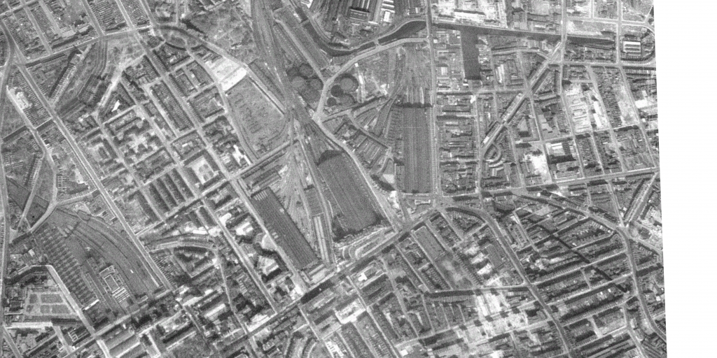
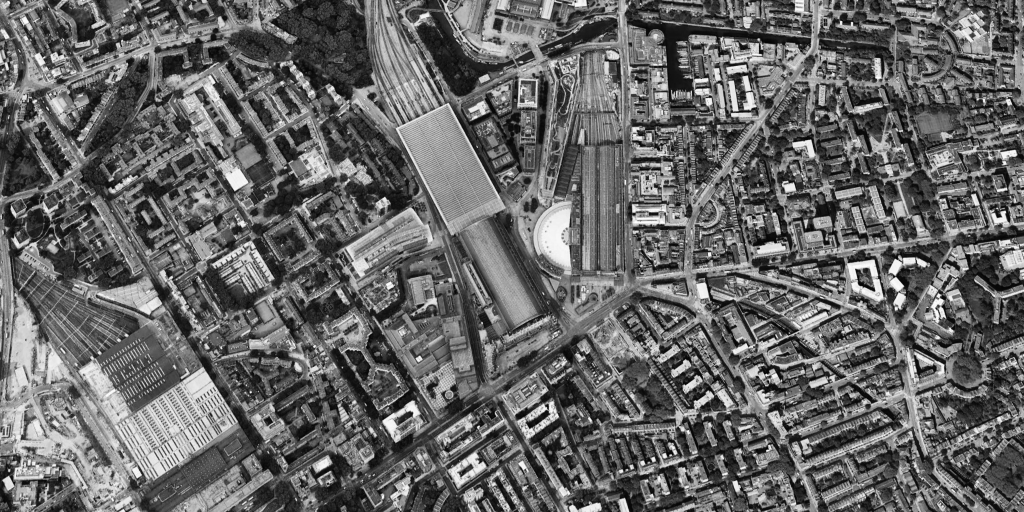
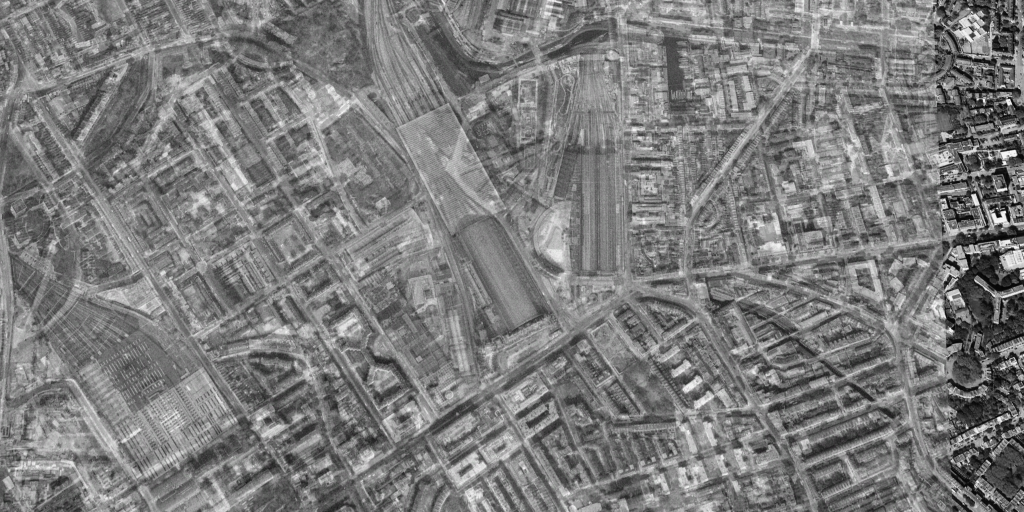
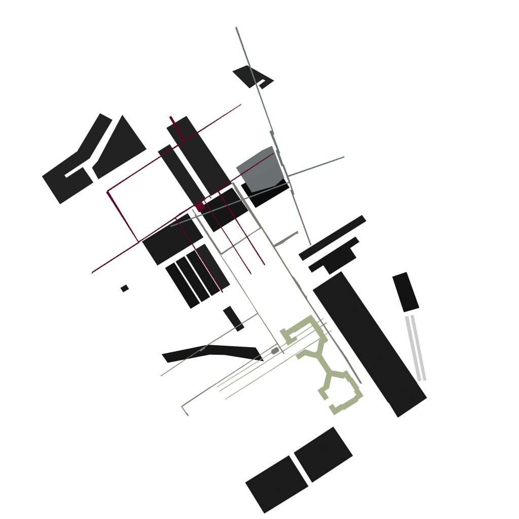
Firstly, I used Google Earth Pro as a tool to delineate the buildings that had been demolished and subsequently redeveloped. I utilised the time-stamped aerial images of Somers Town in 1945 and 2025, to determine where had experienced urban regeneration (Google Maps, 1985, 2025).
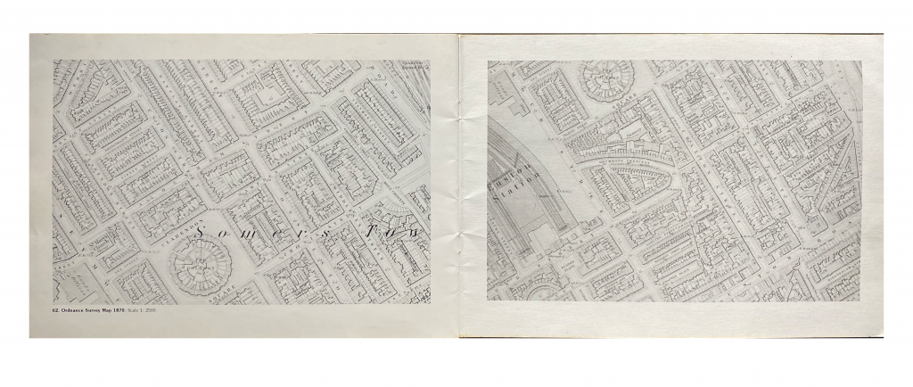
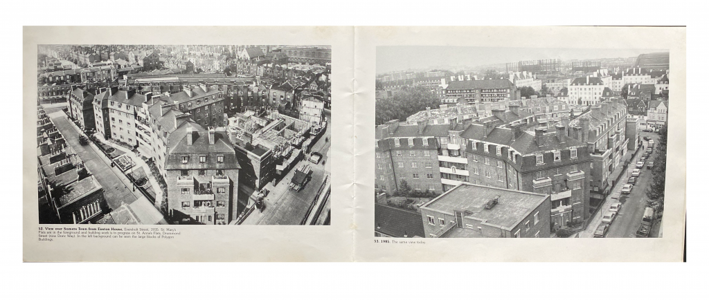
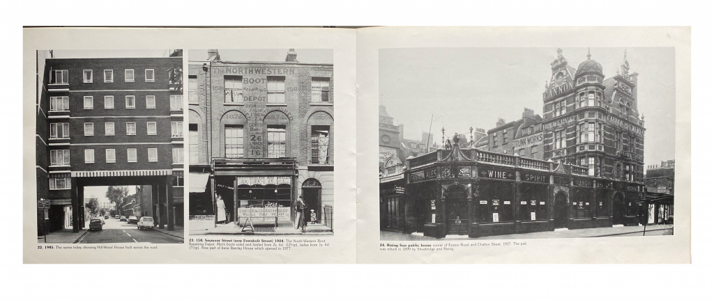
Somers Town: A Record of Change by Malcolm J. Holmes (1985) also provided key historical context to the change experienced in the immediate area. Ordnance Survey Maps, dating from 1870, alongside photographs from the early 20th Century, revealed the extreme extent of change in the area (Holmes, 1985).
It is impossible to overlook the history associated with Somers Town, as it has affected all aspects of life, creating a melting pot of people and architectural typologies alike. This brief historical into area aided me in contextualise my research and informed my line of enquiry, which focused on the relationship between ‘Maker’s Marks’ and urban regeneration.
Reference List:
Google Earth Pro (1945) ‘Somers Town, London’. https://earth.google.com/web/@51.53157117,-0.1314429,19.85086413a,1537.82259227d,35y,359.9980991h,0t,0r/data=ChYqEAgBEgoxOTQ1LTEyLTMxGAFCAggBQgIIAEoNCP___________wEQAA?utm_source=earth7&utm_campaign=vine&hl=en (Accessed October 1 2025).
Google Earth Pro (2025) ‘Somers Town, London’. https://earth.google.com/web/@51.53157117,-0.1314429,19.85086413a,1537.82259227d,35y,359.9980991h,0t,0r/data=CgRCAggBQgIIAEoNCP___________wEQAA?utm_source=earth7&utm_campaign=vine&hl=en (Accessed October 1 2025).
Holmes, M. J. (1985) Somers Town: A Record of Change. London: London Borough of Camden Libraries and Arts Department.
Leave a Reply